Geology

Dwejra Geology and Geomorphology

Dwejra's Geology

What will you learn in this section?

Dwejra is a site that exhibits a menagerie of interesting geological and geomorphological features.  In this section you will learn how the Maltese islands came to be, and will come to understand some of the processes that have formed different structures at Dwejra.  In particular, you will learn about these three types of geomorphological features: sinkholescaves, and natural arches. Dwejra is a site that allows us to observe the entire sequence of formation leading from caves to tunnels, arches, and stacks.

Sinkholes
Caves
Natural Arches

Sinkholes are natural depressions in the ground, and their high concentration in Dwejra makes the site unique.

Caves are hollows in the ground or cliff walls that come about via weathering of the rock. Dwejra offers a number of examples to explore.

Natural arches form via erosion processes over many years, until they collapse, either leaving a stack or disappearing altogether.

How did the Maltese Islands form?

Before proceeding to Dwejra itself, we shall first talk a little bit about how the Maltese islands came to be.  The captivating story of the islands’ formation will, in turn, help us better understand the beauty that we find in Dwejra.

First off, have a look at the figure below, in particular the blue-orange timeline at the top.  Do you see the yellow bit on the right?  That’s where our story of the Matese islands begins, at the beginning of the period known as the Jurassic. (The part from the Jurassic to the present day is expanded in the lower figure.)  As you can see, the Maltese islands’ story is a fairly recent one when compared to Earth’s lifetime!

The Geologic Timeline (Image: J. Caruana)

At the time of the Jurassic, the continents were not separate like today. Rather, they were bunched up in a huge landmass called Pangea.  During the Jurassic, an ocean called Tethys formed.  This ocean is what would later on become the Mediterranean as we know it.

Rivers flowing into the Tethys deposited sediments at its bottom.  You might be asking: what sort of sediments?  Stuff like coral remains, for example, constituted such sedimentary deposits.  These sediments are the very basis of what would later become the Maltese islands.  Yes, that’s right – the  very rocks on which you stand in Malta are the remains of past living creatures!

When the African continent started moving towards the Eurasian one, these sediments lying at the bottom of Tethys were caught in between; as a result, as Africa and Eurasia moved ever closer to each other, the sediments were pushed upwards, forming bumps and creases throughout this early form of the Mediterranean sea.  Around 7 million years ago, some of these sediments got pushed up sufficiently to emerge above sea level – and they became the Maltese islands.  Only that they didn’t stay there!  Over the next several years they probably submerged and re-emerged a number of times.

The Ocean Tethys at the beginning of the Jurassic. (Image adapted by J. Caruana from a creative commons file; details at bottom of page.)
The five main sedimentary layers that form the Maltese islands.

In the above account, we kept mentioning the sediments that constitute the Maltese islands, but we have yet to look at them a bit more closely.  The main types of sediments that make up the Maltese islands are five.  From the lowest and oldest to the highest and youngest, they are the following:  

  1. Lower Coralline Limestone (Zonqor or Qawwi ta’ Taht), 
  2. Globigerina Limestone (Franka), 
  3. Blue Clay (Tafal), 
  4. Greensand (Gebla s-Safra or Rina), and 
  5. Upper Coralline Limestone (Qawwi ta’ Fuq).

The oldest layer, the Lower Coralline Limestone, took around 10 million years to form and contains coralline fossils as well as fossils of the famous Scutella subrotunda, a sea urchin of that time (see figure below).

The next oldest layer, the bright yellow Globigerina Limestone, is the thickest layer and formed in sea depths ranging from 40m to 150m.  It contains fossils of molluscs, sharks, and crocodiles amongst others, and is the stone of choice for building construction on the Maltese islands.

A level up comes Blue Clay, a soft layer which again contains a variety of fossils from creatures that lived during its time of formation – the Miocene, (refer to timeline above).  Such fossils include coral and forams (foraminifera).

Next we encounter the rarest layer of them all, Greensand, which contains fossils of large animals such as whales and dolphins.

The topmost and most recent layer is the Upper Coralline Limestone that formed in shallow waters and counts sea urchins, molluscs and forams amongst its fossilised remains.

An example of a fossil in Dwejra of a sea urchin (Scutella subrotunda) that used to exist back when Lower Coralline Limestone was still being formed around 25 to 30 million years ago. (Image: J. Caruana)

A major event that changed the Mediterranean happened around 6 million years ago, when the Mediterranean sea started to dry up in what is known as the Messinian Salinity Crisis.  The reason for this drying was that the strait of Gibraltar, which supplies water from the Atlantic Ocean to the Mediterranean, became closed.  To this very day, the Mediterranean loses more water than can be replenished by the rivers that flow into it, so cutting off the supply of seawater from the Atlantic condemns the Mediterranean to drying up.  During the Salinity Crisis, what was left of the Mediterranean were just pools of salt water – and the Maltese islands became connected to Sicily, which in turn became connected to the rest of Europe.  (Watch the animation on the right.)  This event lasted until around 5 million years ago, when the strait of Gibraltar reopened, and the Mediterranean filled up with water again.

Now that we have had this brief look at the history of the Maltese islands, we can proceed to look in closer detail at some of the geologic processes and geomorphologic features that we find at the site of Dwejra itself.

Sinkholes

Sinkholes are very interesting geomorphologic features found in many places around the world.  The west coast of Gozo is host to several.  Dwejra alone hosts four sinkholes, namely Dwejra Bay, the sinkhole at Il-Qasir, and the Inland Sea (see the figure below).  This high concentration of sinkholes lying virtually next to each other makes Dwejra quite unique, such that it merits the highest attention. 

There is no one single process that forms each and every sinkhole, and here we will specifically limit our discussion to sinkholes of the type we find in the Maltese islands.  In some cases, such as at  Wied il-Maqluba in Malta, the process starts with rainfall seeping through limestone.  Since the pH of rainwater is slightly acidic, it gradually dissolves the limestone and eventually causes dissolution in the evaporite lying underneath.  (Evaporite is a natural salt that is left behind when sea water evaporates. It is probable that evaporites in Malta predate the Oligocene period, i.e. the period between 40 and 28 million years ago as shown on the geologic timeline diagram at the top of the page).  A cave is thus formed, and when the ceiling thins out sufficiently, the limestone above collapses and leads to a sinkhole forming at the site (see Figure on the right).  

The formation of a circular subsidence structure via a Karst process. (Animation: J. Caruana)
Three of the four sinkholes found in Dwejra. (J. Caruana)

To get a view of the three other sinkholes in Dwejra (although only two of these have contours that are clearly appreciable by eye) one merely has to walk up to Fuq il-Qawra to obtain a view of Ta’ Slima cliffs.  Here, one can observe how these cliffs curve inwards twice, as if tracing the number three.  It does not require a lot of imagination for one to be able to envisage circles that have these cliffs tracing part of their circumference.

One can observe how the Lower Coralline Limestone cliffs at Tal-Hawt turn downwards towards the edge, signifying a collapse in the past. (Image: J. Caruana)
Three other sinkholes in Dwejra. (Image: J. Caruana)

In the case of the furthermost sinkhole (annotated as ‘Sinkhole 3’ in the figure above), one can note how the Lower Coralline Limestone cliffs turn downwards close to the cliff edge (known in Maltese as Tal-Ħawt), marking the collapse of what would have been a large cave in the past.  Therefore, you can see that while we may not be able to visually make out the contour of this sinkhole (as with the more “obvious” cases of the Inland Sea and Dwejra Bay sinkholes that we saw above, for instance), we still have evidence for past collapse at this site.  Apart from the sinkholes we discussed here, yet more might exist offshore, hidden underwater.

Natural Arches

Natural arches form via erosion processes over many years.  There are various types of arch formation mechanisms, the particulars depending on the location in which they’re found. 

Arches such as the recently collapsed Azure Window in Dwejra are known as coastal arches.  The process involves differential erosion, whereby certain rocks erode faster than others. Arches start off as a cave (or even two caves on opposite sides of a promontory), with wave action enlarging them until they become an arch.  The arch itself commonly evolves from a rectangular, window-like shape to a curved arch.  The precise cause of eventual collapse depends on the specifics of a given arch, and can come about gradually via continued rock fall, with a stack being left behind.  

As has been witnessed with the Azure Window in Dwejra, if the pillar itself is weakened, the ensuing result can be the total collapse of the entire structure, pillar and arch both included. A detailed study of the remains has just been completed.

This simple animation shows a schematic representation of how it is thought the Azure Window formed and, eventually, collapsed. (Animation: J. Caruana)

Geomorphological Features in Dwejra

The Inland Sea

The Inland Sea (known in Maltese as Qawra) is one of the four sinkholes we find in the Dwejra area, and from a geomorphological point of view is possibly the most interesting feature at Dwejra.  Measuring between 300m and 400m, it is the largest subsidence structure at this site.  An 80m-long channel known as L-Ghar tad-Dwejra (see picture on the right) links the lagoon to the open sea. The mechanism behind the formation of this tunnel is called slab failureand is tightly linked to the formation of arches such as the now-collapsed Azure window.  Indeed the tunnel of the Inland Sea can help us in our understanding of one of the first stages that lead to the formation of natural arches (more on that further below).  Following its initial formation via slab failure, wave action over many years has kept enlarging this tunnel which is a favourite destination for scuba divers.

The Inland Sea during rough weather. (Image: J. Caruana)
The Inland Sea (Image: J. Caruana)

The Fungus Rock

The Fungus Rock, known in Maltese as Il-Gebla tal-General or Hagret il-General, is a small limestone islet at Dwejra Bay.  It used to be connected to the mainland via an arch that collapsed, with the fungus rock itself being the remaining stack.  As such, together with l-Ghar tad-Dwejra at Qawra it helps us in our reconstruction of the various stages in the lifecycle of natural arches, with the Fungus rock representing the last stage in this process. Most people observe the Fungus Rock from Il-Misjad at Dwejra Bay, looking towards the South.  However, an impressive view is also to be had looking down on the Fungus rock from Tal-Ħarrux, as in the picture on the right. From this vantage point one can also observe some of the fissures in the rock.  As with all coastal areas, the Fungus rock is under constant attack of the waves during rough weather and its story is not over yet.

The Blue Hole (Il-Ħofra tal-Bidwin)

The Blue Hole (known as Il-Ħofra tal-Bidwin is a blowhole in Dwejra, measuring around 9X10 metres.  Whilst enclosed from three of its sides, the North-West facing wall has collapsed, and all that remains is an arch reaching down to about 6 metres below sea level, which is adorned with golden cup coral (parazoanthus axinellae). This arch forms a spectacular window leading out to the open sea.  At the bottom of the hole at 16m, there is a cavern in the South-Eastern wall, directly opposite the arch of the Blue Hole.

As one may expect, the Blue Hole with its splendid underwater scenery is a huge attraction for divers (you can read more about diving this site on the scuba diving page), but equally beautiful are the processes that lead to such formations in the first place, where various physical forces come together to create complex structures.

View of the Window formed by the arch of the Blue Hole, as seen from the exit of the cavern at the bottom of the Blue Hole. (Image: J. Caruana)
The Blue Hole as seen from the air. (Image: J. Caruana)

The Azure Window (It-Tieqa tad-Dwejra)

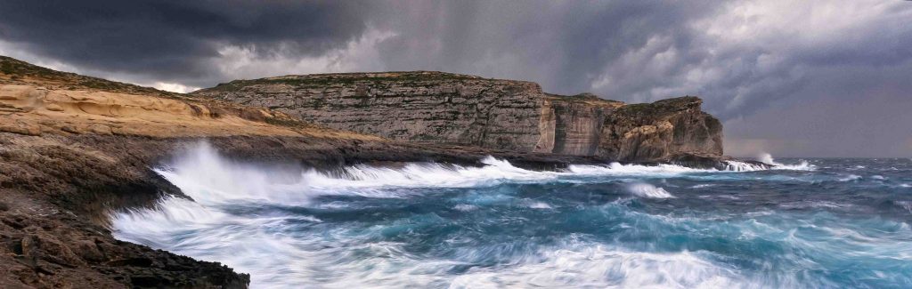
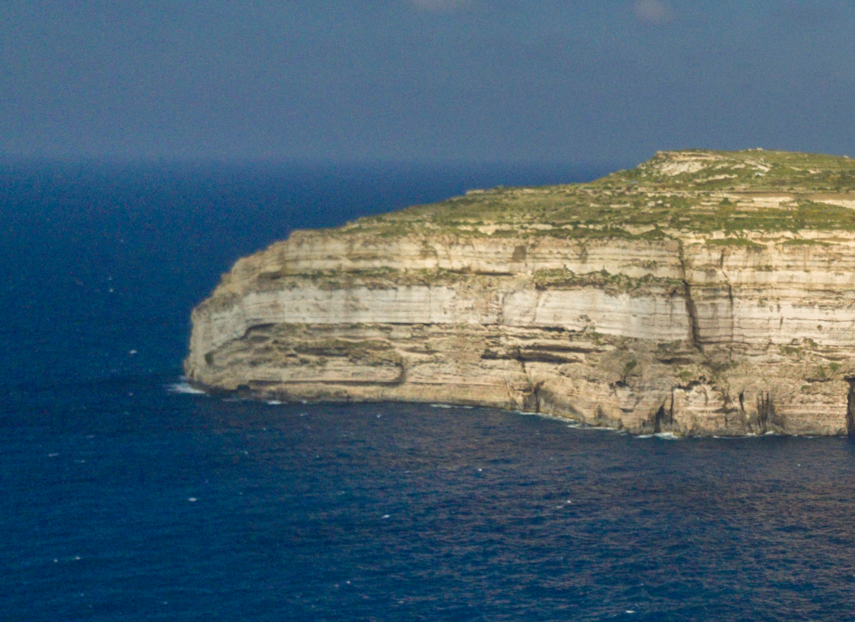
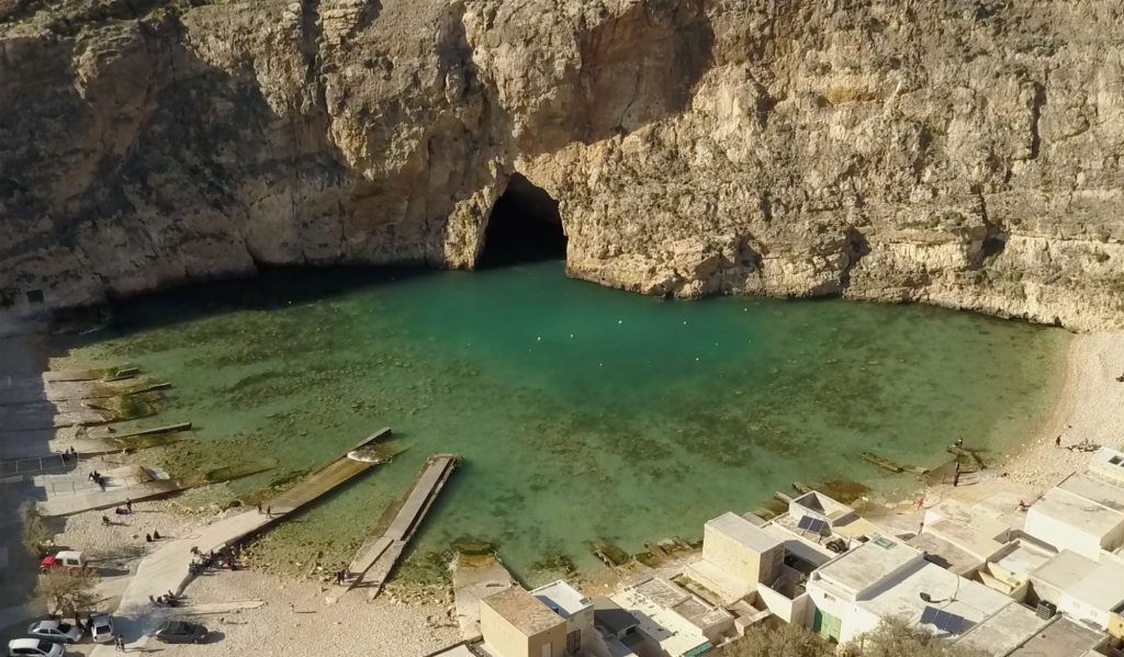
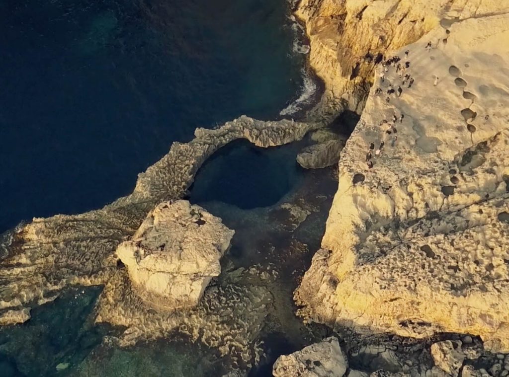
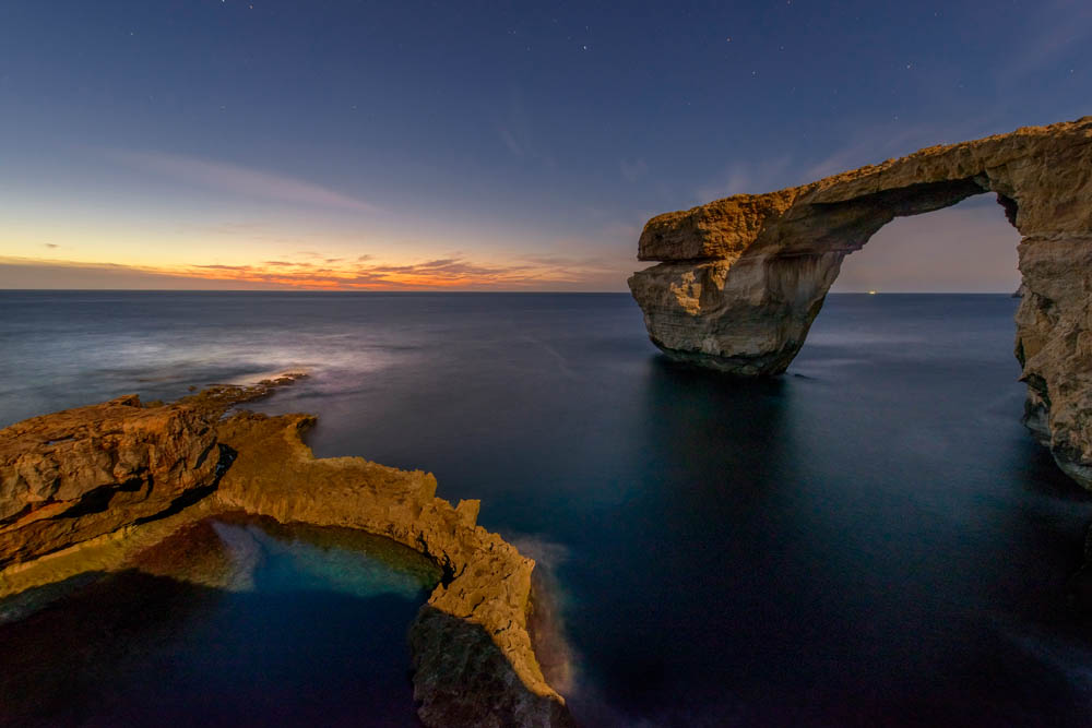
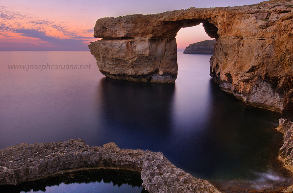
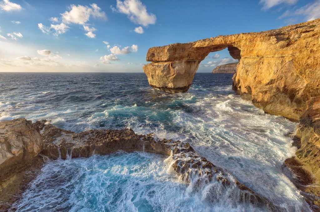
It-Tieqa tad-Dwejra, or is it was known in English, The Azure Window, used to be a natural arch.  This rock formation was one of the most well known features at Dwejra, and over the years became an iconic landmark that was synonymous with Gozo and a major tourist attraction for the Maltese islands.  

Thought to have come about from the collapse of a cave in the 1800s, over the years erosion ate at this structure until on the 8th of March, 2017 it collapsed together with the pillar that supported it.

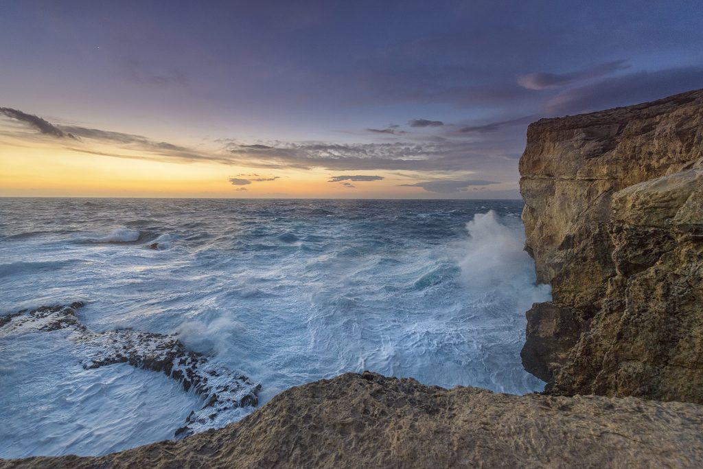
It is thought that the pillar itself led to the demise of the Azure Window. Significantly weakened, it gave way during a storm which saw gale-force North-Westerly winds, and the whole structure came down in the process.

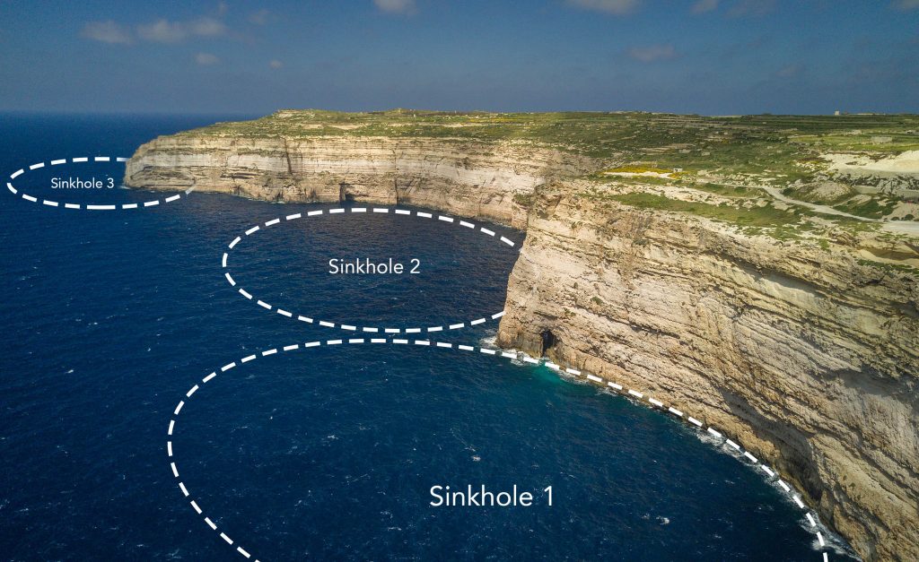
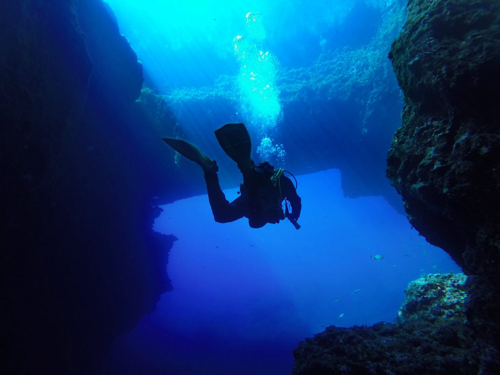
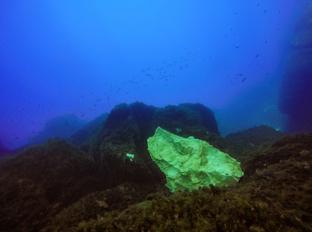
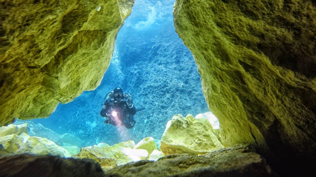
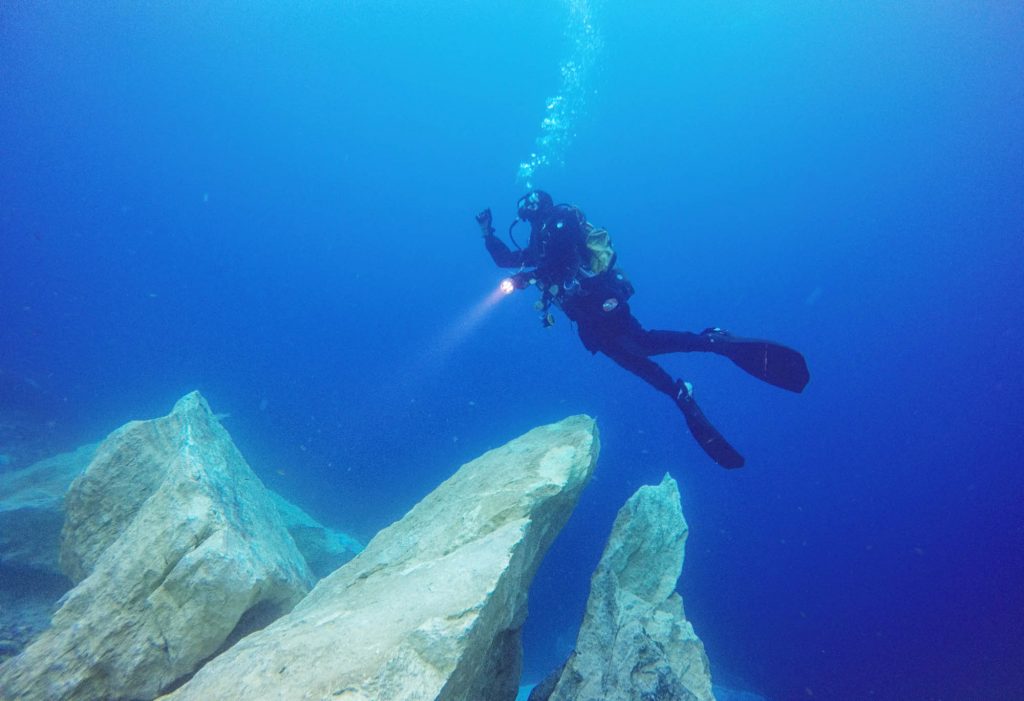
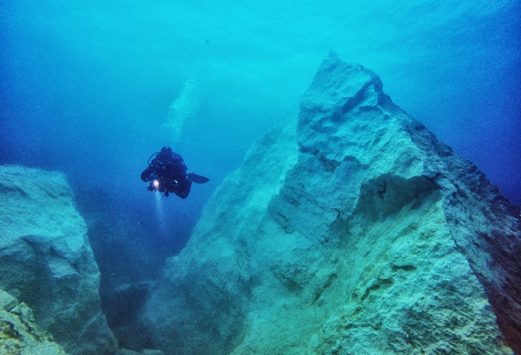
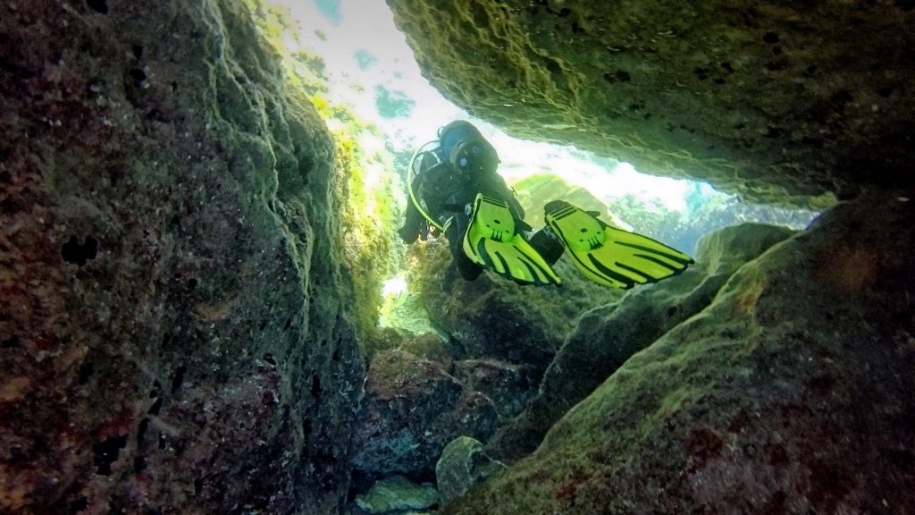
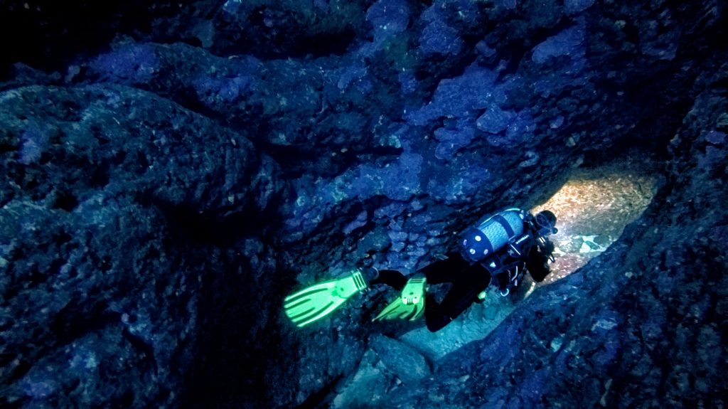
Early video footage and photos obtained by scuba divers show that the South-facing wall collapsed, with part of the pillar facing the North left still standing beneath the water up to around 5 metres below sea level.

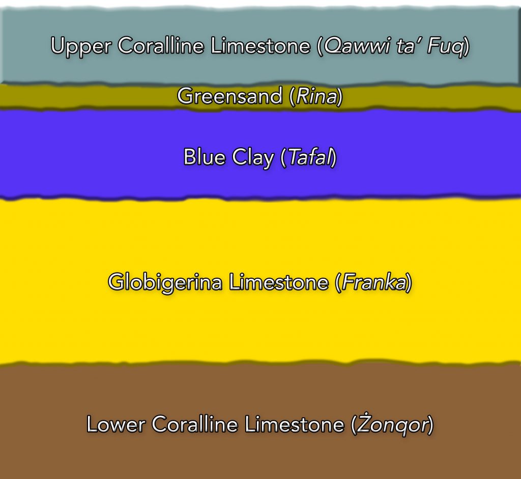
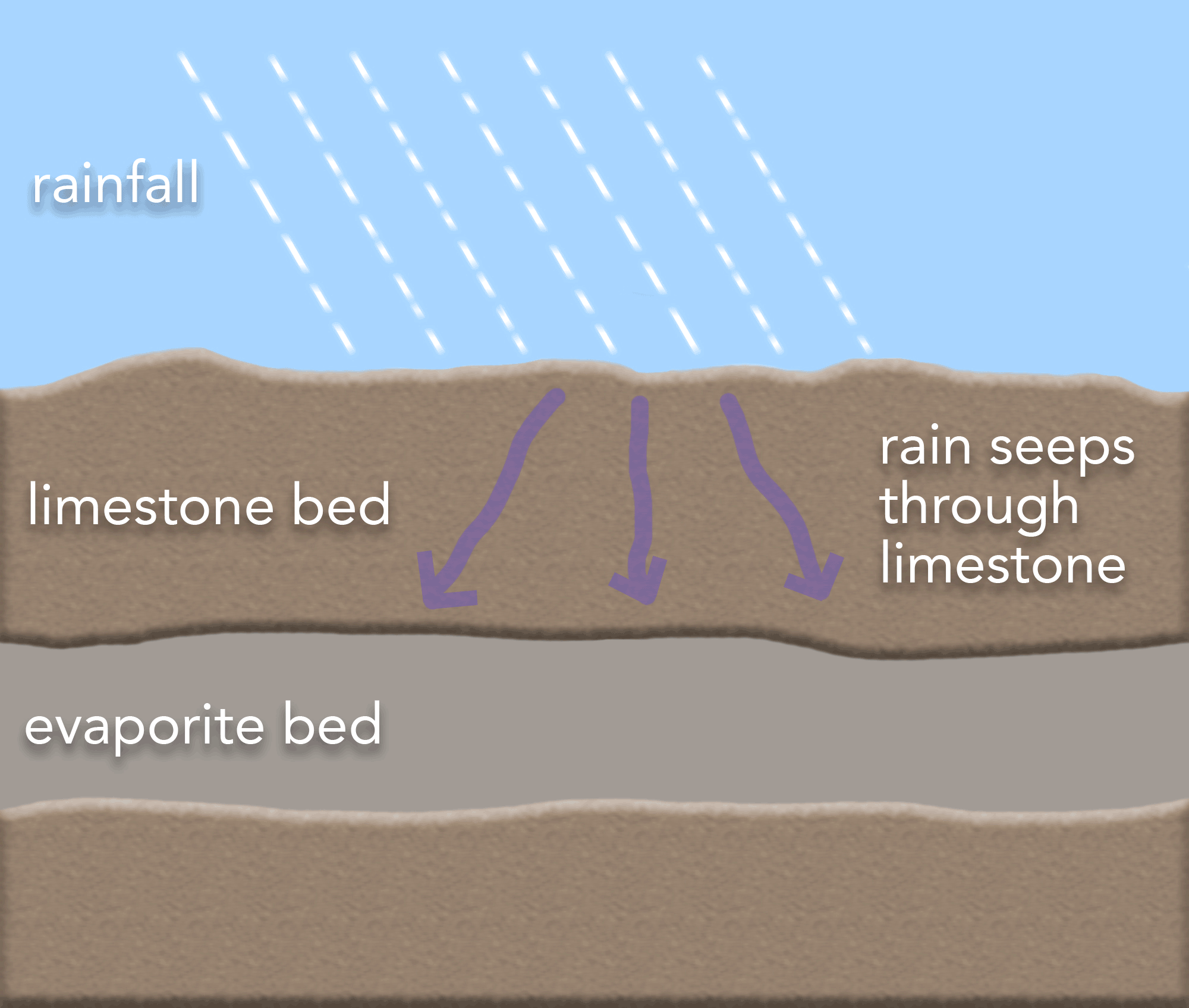
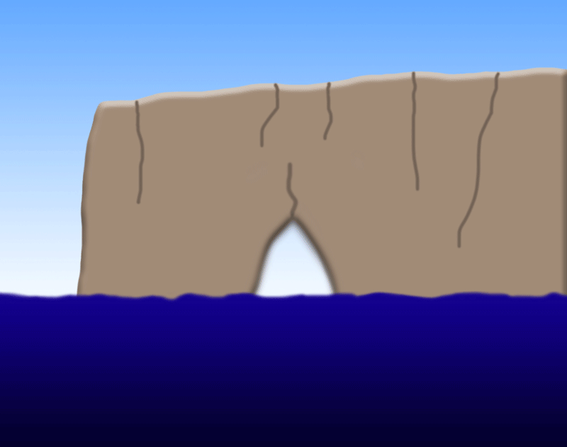
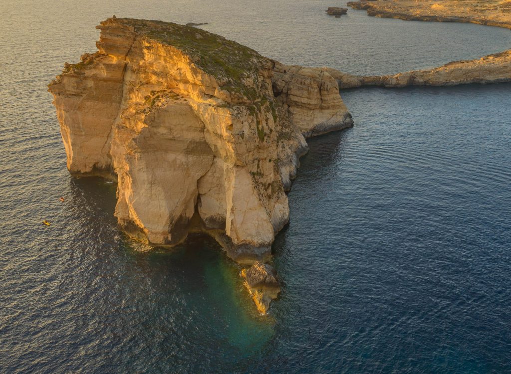
The lifecycle of the Azure Window started with a crack in the rock abetted by sea and rain erosion, widening into a cave that became an arch.  Over the years, erosion and wave action kept eating away both the arch and the pillar, and the Azure Window became ever wider.  Whilst such structures sometimes see the arch itself failing leaving behind a stack (such as with the Fungus Rock), in the case of the Azure Window, the pillar was significantly weakened below sea level (as evidenced also by numerous scuba divers who could witness numerous fissures), until it gave way.

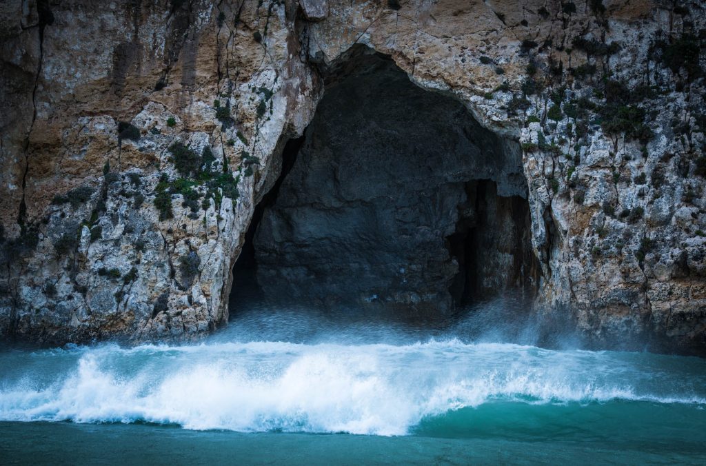
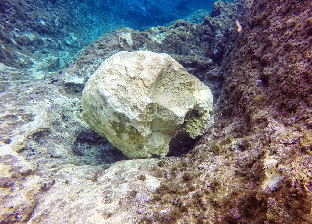
Comparing pictures taken over the years (see below photographs) illustrates the erosion process at work.  In recent years, scuba divers regularly encountered fresh rocks underneath the Azure Window as it continued to sustain the attack of waves during rough weather (see image on the right).

The (now collapsed) Azure Window is seen on the right, with the blue hole dominating the left part of the image. (Image: J. Caruana)
An image (captured in April 2015) that shows a freshly fallen rock from the structure that used to be the Azure Window. (Image: J. Caruana)

Whilst highly popular when it was still standing, it is apt to highlight the fact that natural arches have short lifetimes with respect to other geological features we encounter.  (In fact, it’s thought that the Azure Window had perhaps formed as recently as the early 19th century.)  Therefore, we can appreciate that arches are short-lived, transitory phenomena which, while attractive, are just one short phase amongst many.  Furthermore, the collapse itself is a very interesting event, as are subsequent phases.  The future the Azure Window lies beneath the waves, with its remains scattered in pieces both large and small on the sea floor.  Over the years these will become a reef.  This process will be followed closely by divers who are keen naturalists.

Submerged Geomorphology

Apart from the features that we can see on land, there is a diversity of geomorphology underwater that is all but hidden except for those who dare venture underwater.  Caverns, chimneys, arches, and swim throughs are some of the wonders that scuba divers can enjoy underwater at Dwejra.

A diver finning through a swim-through at Dwejra. (Image: J. Caruana)

As the saying goes, the only constant is change.  Dwejra underwater continues to present a changing landscape.  As weathering and erosion continue their work, and wave action relentlessly attacks the coast of Dwejra, faulting causes some rocks to fall into the sea.  As an example, the picture on the right showcases a freshly collapsed rock (unrelated to the Azure Window) that was encountered on a recent dive by the author.  (In this particular case, it would even seem that the rock was transported over some distance from the site where the rockfall occurred.)

Many structures and features in Dwejra, from underwater caves to the shapes of its cliffs,  will look very different in the future than how they are at present.  What is important to understand is that this change is another facet of the beauty of nature, as it continues to wield its power and carve new masterpieces.  We are here now, witnesses to fleeting creations before further changes – some drastic – are made to the ever-changing canvas that is Dwejra. We should not interfere, but watch this spectacle unfold.

A scuba diver about to enter one of the submerged caverns at Dwejra. (Image: J. Caruana)

Each of these features is worth a page of its own.  However, for the time being this discussion will be paused here.  Hopefully, the above will have given you an idea of the menagerie of beautiful structures that nature has carved at Dwejra.

Suggested Further Reading on Geology

  • Exploring Earth: An Introduction to Physical Geology (2nd Edition) by J.P. Davidson, W.E. Reed and P.M. Davis, Prentice Hall, 2001.
  • Understanding Earth (4th Edition) by F. Press, R. Siever, J. Grotzinger and T. Jordan, Freeman, 2003.
  • Fundamentals of Geophysics by W. Lowrie, Cambridge University Press, 2007.